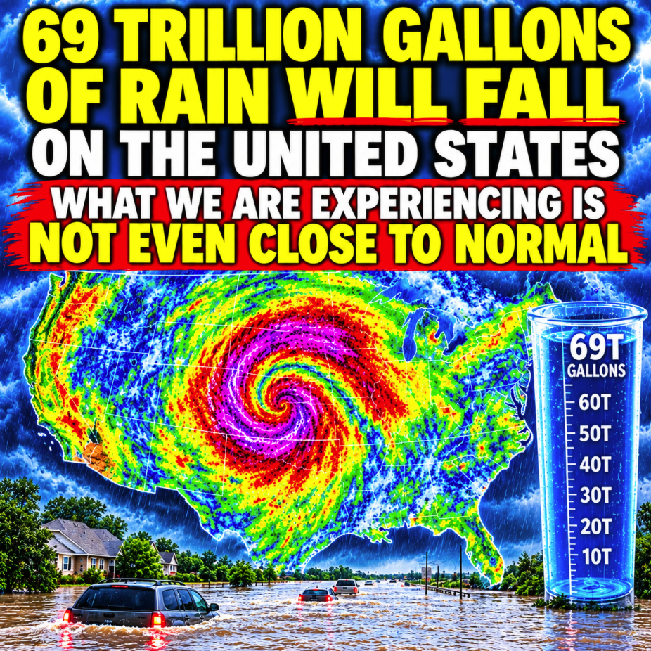
A colossal “hybrid storm” is dumping almost unthinkable amounts of rain over the middle of the nation right now. The remnants of two hurricanes have combined with a very powerful upper level low to create a historic deluge that will be hammering us for days. Earlier this year I kept warning my readers that the Super El Niño of 2026 would bring absolutely crazy weather to the United States, and at first there were some people out there that didn’t want to believe me. But now we are being hit by one natural disaster after another, and experts are warning that what is ahead is going to be even worse.
According to meteorologist Ryan Hall, from Sunday to next Wednesday a total of 69 trillion gallons of rain will fall on the United States…
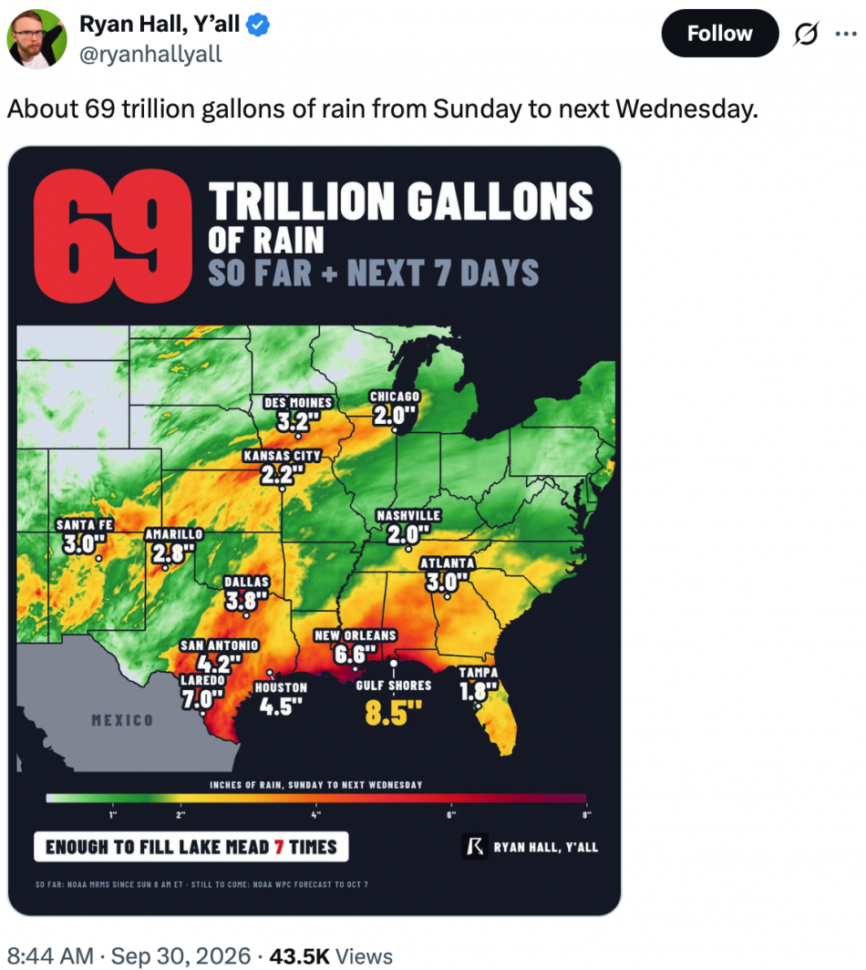
I have never seen anything like this, and all of this rain is going to cause tremendous flooding.
In fact, severe flooding has already begun in the Southwest…
A major flood event is unfolding across the southwestern and central United States as residual tropical moisture from two hurricanes clashes with another storm swinging in from the west. This three-pronged weather event comes just days after some areas of the Southwest were saturated by heavy rain, resulting in an even higher risk of flash flooding.
New Mexico has been hit particularly hard.
After a 20 foot tall dam wall was breached, water came pouring into the small rural community of Garfield, New Mexico…
Floodwaters breached a 20-foot dam wall in southern New Mexico on Tuesday, sending water into Garfield as tropical moisture fueled dangerous flooding across the Southwest.
Video captured flooding in the community after the breach, marking a sharp escalation in a flooding emergency that had already prompted residents near McLeod Dam to evacuate.
Earlier Tuesday, the National Weather Service issued a flash flood emergency after dam operators and county officials reported that failure was imminent.
Of course that wasn’t the only area that was suddenly underwater.
CBS News reported that the rain was coming down in some parts of the Southwest at a rate of 4 inches per hour, and over 60 flash floods occurred…
Heavy rain has already flooded some roads in southern New Mexico, trapping drivers in cars until the waters receded.
Those rains Tuesday put the McLeod Dam in Dona Ana County in southern New Mexico on the brink of failing. The National Weather Service issued a flash flood emergency due to the dam, while county officials issued evacuation orders for the region. A county spokesperson told CBS News that pumps were being brought in to pump water downstream of the dam and alleviate the pressure on it.
More than 60 flash floods were reported across the Southwest from Monday to Tuesday night, with rainfall rates in some areas as high as 4 inches per hour.
Today, flood watches were issued in the states of Arizona, Colorado, Iowa, Kansas, Missouri, Nebraska, New Mexico, Oklahoma and Texas.
Over the next 48 hours, the rainfall is going to be relentless.
The good news is that this “hybrid storm” will ultimately pass.
The bad news is that the Super El Niño of 2026 hasn’t even peaked yet, and it will continue to produce more epic storms.
Scientist Daniel Swain has admitted that this El Niño is so “monstrous” that we “don’t have a categorization for this”…
Well, this one is shaping up to be monstrous. Though to be clear, that isn’t an actual category. That tops out at “very strong.” We don’t have a categorization for this.
Interestingly and alarmingly, the forecast for this fall suggests that it’s going to strengthen so much more that it will no longer matter which index we use, it will most likely be record breaking by late autumn either way. It’s going to further separate from the pack. This year is going to be tumultuous.
This Super El Niño has already prompted California Governor Gavin Newsom to declare a state of emergency, and now a colossal “Kelvin wave” that has been created by this Super El Niño “is arriving along the California coast”…
An oceanic Kelvin wave, a kind of slow-moving planetary wave that carries energy and warm water across vast distances, is arriving along the California coast, said Daniel Swain, a climate scientist with the University of California Agriculture and Natural Resources.
“Sea levels are going to be noticeably higher than usual,” Swain said.
The wave comes amid a flurry of other oddities brought on by the strong El Niño: Warmer water temperatures along portions of the California coast, unusual sightings of sea life typically seen in warmer waters and a hyperactive hurricane season in the Pacific.
Everyone is freaking out because this Kelvin wave is going to cause water levels to increase substantially.
In some areas, we could see the Pacific Ocean rise by a foot or more.
But what is really concerning authorities is what will happen when huge storms start rolling in during the months ahead…
If the rising waters coincide with other climatic events, such as rainstorms and high tides, the phenomenon could swallow beaches, chew away bluffs and coastlines, and submerge streets, homes and businesses.
“This coming Kelvin wave is just the beginning,” said Dr Jonathan Warrick, a research geologist at the US Geological Survey. “The thing to look out for is what will happen in January, February and March – that’s when we get the biggest storms, we get our largest waves and we have some very large tides.”
If these events align, their effects will compound, setting the stage for a tumultuous winter. Together, Warrick said, the systems will pack a far bigger punch. “When it comes to these storms and the tides,” he said, “we really are kind of rolling the dice.”
If you live directly along the west coast, this is going to be a very challenging time.
I hope that you have good insurance.
All of the very warm water that the Kelvin wave is bringing in will be ideal fuel for giant storms.
Right now, Hurricane Rachel is quietly churning in the Eastern Pacific.
It is currently a Category 1 storm, but by Saturday it is expected to have sustained winds of 104 miles per hour.
Will it make a turn toward California?
Meteorologists are not currently expecting that to happen, but we now live at a time of permanent uncertainty when it comes to the weather.
Michael’s new book entitled “10 Prophetic Events That Are Coming Next” is available in paperback and for the Kindle on Amazon.com, and you can subscribe to his Substack newsletter at michaeltsnyder.substack.com.

About the Author: Michael Snyder’s new book entitled “10 Prophetic Events That Are Coming Next” is available in paperback and for the Kindle on Amazon.com. He has also written nine other books that are available on Amazon.com including “Chaos”, “End Times”, “7 Year Apocalypse”, “Lost Prophecies Of The Future Of America”, “The Beginning Of The End”, and “Living A Life That Really Matters”. When you purchase any of Michael’s books you help to support the work that he is doing. You can also get his articles by email as soon as he publishes them by subscribing to his Substack newsletter. Michael has published thousands of articles on The Economic Collapse Blog, End Of The American Dream and The Most Important News, and he always freely and happily allows others to republish those articles on their own websites. These are such troubled times, and people need hope. John 3:16 tells us about the hope that God has given us through Jesus Christ: “For God so loved the world, that he gave his only begotten Son, that whosoever believeth in him should not perish, but have everlasting life.” If you have not already done so, we strongly urge you to invite Jesus Christ to be your Lord and Savior today.